Hey there, curious minds! Have you ever wondered about the amazing things that make up the land we live on? Well, you’re in for an exciting ride as we delve into the incredible world of the physical features of India.
From towering mountains to vast deserts and everything in between, India is a land full of diverse and breathtaking natural features and wonders. So, let’s embark on this journey together and uncover the fascinating landscapes that shape the heart of India.
Mountains to Deserts
As we start our exploration, it’s important to understand what exactly we mean by “physical features.” These are the different types of land and water formations that you can find in a country. Think about the mountains that touch the sky, the rivers that flow through the valleys and even the oceans that stretch as far as the eye can see – all of these are part of a physical features of India. And India, oh boy, it’s like a treasure trove of these amazing natural elements.
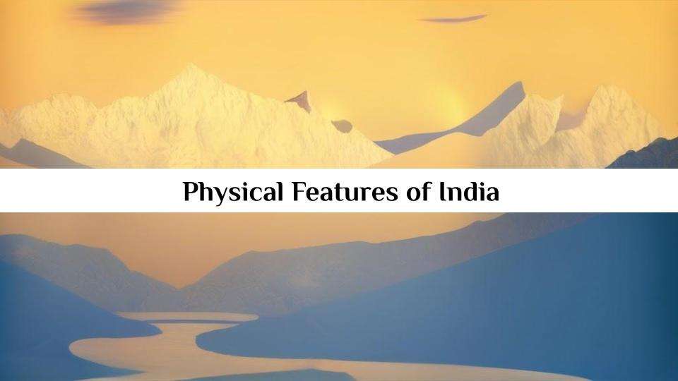
Himalayas
Imagine standing at the foot of gigantic mountains that seem to touch the clouds. These are the famous Himalayas, a mountain range that spans across the northern part of India. This is also a one of the physical feature of India.
You’ll be amazed to know that the Himalayas are home to some of the tallest peaks in the world, like Mount Everest! These mountains not only add to India’s breathtaking beauty but also play a vital role in shaping its climate and the lives of the people who call these mountains their home.
Rivers
But wait, that’s not all! Let’s talk about rivers. Picture this: long, winding waterways that crisscross the landscape, bringing life to the soil and the people. India is blessed with a network of rivers that flow through its plains and plateaus such as the Ganges, the Yamuna and the Brahmaputra. These rivers are like lifelines which provides water for drinking, farming and many other essential activities.
Deserts
Now, close your eyes and imagine a vast stretch of golden sand dunes, where the sun paints the sky with hues of orange and pink during sunset. Welcome to the Thar Desert, a unique part of India’s landscape located in the western region. This desert might seem barren, but it’s teeming with life specially adapted to its harsh conditions. It’s a place of contrasts, where scorching days turn into chilly nights.
Ready to explore
As we journey through this blog, we’ll not only be learning about these remarkable physical features but also discovering how they’ve influenced India’s culture, history and people. From the lush forests of the Western Ghats to the coastal beauty of the Indian Ocean, every corner of this country has a story to tell. So, buckle up, because our adventure into the mesmerizing world of India’s physical features has only just begun!
Physical features of India
1. Geographic Extent
- India is the seventh-largest country in the world by land area.
- It spans approximately 3.28 million square kilometers.
- India’s northernmost point is in the region of Ladakh.
- The southernmost point is Indira Point in the Andaman and Nicobar Islands.
- India’s easternmost point is in the state of Arunachal Pradesh.
- The westernmost point is in the Kutch region of Gujarat.
- India shares its borders with Pakistan, China, Nepal, Bhutan, Bangladesh and Myanmar.
- The country is surrounded by the Indian Ocean on three sides.
- The coastline stretches over 7,500 kilometers.
- India’s maritime boundary includes the Arabian Sea and the Bay of Bengal.
2. Himalayan Mountains
- The Himalayan mountain range stretches across northern India.
- It includes some of the world’s highest peaks such as Mount Everest.
- The Indian states of Jammu and Kashmir, Himachal Pradesh and Uttarakhand are located in the Himalayan region.
- The Himalayas are a source of many major rivers in India including the Ganges, Brahmaputra and Yamuna.
- The Great Himalayan National Park in Himachal Pradesh is a UNESCO World Heritage Site.
- The Himalayas are still rising due to tectonic activity.
- The region is prone to earthquakes and landslides.
- Popular hill stations like Shimla and Manali are in the Himalayan foothills.
- The Himalayas are home to diverse flora and fauna including the snow leopard.
- The Siachen Glacier, known as the world’s highest battlefield, is in the Himalayas.
3. Northern Plains
- The Northern Plains of India are formed by the fertile Gangetic and Brahmaputra river basins.
- These plains are some of the most densely populated areas in the world.
- They are known for their alluvial soil which is ideal for agriculture.
- Major cities like Delhi, Kolkata and Lucknow are located in this region.
- The Ganges and Yamuna rivers flow through these plains.
- The Ganges is considered sacred by Hindus and is known for its religious significance.
- The Sundarbans Delta, where the Ganges and Brahmaputra meet, is famous for its mangrove forests and Bengal tigers.
- The Northern Plains experience extreme temperatures with hot summers and cold winters.
- The region is prone to flooding during the monsoon season.
- The Indo-Gangetic Plain is a significant cultural and historical center.
4. Western Ghats
- The Western Ghats are a UNESCO World Heritage Site.
- They run parallel to the western coast of India.
- These mountains are known for their rich biodiversity.
- The Ghats are home to several national parks and wildlife sanctuaries.
- Goa and Kerala are states located along the Western Ghats.
- The highest peak in the Western Ghats is Anamudi in Kerala.
- The region receives heavy rainfall during the monsoon, contributing to lush forests and waterfalls.
- The Western Ghats act as a barrier to the southwest monsoon winds, causing the windward side to be wet and the leeward side to be dry.
- They are also known as the Sahyadri Mountains in some regions.
- The Nilgiri Hills are a prominent subrange of the Western Ghats.
5. Thar Desert
- The Thar Desert is located in the northwestern part of India.
- It is the largest desert in India and one of the largest in the world.
- The desert extends into Pakistan.
- Rajasthan is the Indian state most affected by the Thar Desert.
- The region experiences extreme temperatures, with scorching summers and cold winters.
- The desert has unique ecosystems adapted to arid conditions.
- Several oases are scattered throughout the Thar Desert.
- The Luni River is the only significant river in this region.
- The desert is known for its sand dunes, some of which are over 150 meters high.
- Jaisalmer, also known as the “Golden City,” is a major city in the Thar Desert.
6. Plateaus and Deccan Plateau
- The Deccan Plateau is a vast elevated region in the southern part of India.
- It covers almost two-thirds of the country’s land area.
- The plateau is made up of volcanic rock formations.
- It is home to various hill stations like Ooty and Mahabaleshwar.
- The Western and Eastern Ghats border the Deccan Plateau.
- The Eastern Ghats run parallel to the Bay of Bengal.
- The plateau has rich mineral deposits, including iron ore and bauxite.
- The Deccan Plateau has a semi-arid climate in many areas.
- Hyderabad and Bangalore are major cities located on the Deccan Plateau.
- The Ajanta and Ellora Caves which is famous for their rock-cut architecture are in this region.
7. Eastern Plains and the Ganges-Brahmaputra Delta
- The eastern plains of India are formed by the Ganges and Brahmaputra river basins.
- The Ganges-Brahmaputra Delta is one of the largest in the world.
- The delta is known for its extensive wetlands and mangrove forests.
- Sundarbans, a UNESCO World Heritage Site, is part of this delta and home to the Bengal tiger.
- The Brahmaputra River originates in Tibet and flows through northeastern India.
- The delta is prone to annual flooding during the monsoon season.
- The region has a significant agricultural economy.
- Kolkata, a major city, is located in the Ganges Delta.
- The delta is a critical habitat for migratory birds.
- The Farakka Barrage was built to divert water from the Ganges for irrigation.
8. Peninsular Plateaus
- The Peninsular Plateau lies to the south of the Northern Plains.
- It includes the Malwa Plateau, Chota Nagpur Plateau and the Karnataka Plateau.
- The plateau is rich in minerals and is known for its mining activities.
- The Western and Eastern Ghats border the Peninsular Plateau.
- The plateau region is generally drier than the Northern Plains.
- It has a diverse range of ecosystems from forests to grasslands.
- The Western and Eastern Coastal Plains are found on either side of this plateau.
- Major rivers like the Godavari and Krishna flow through the plateau.
- The plateau has many historic rock-cut temples such as those at Ajanta and Elephanta.
- Bangalore is the capital of Karnataka and located on the Peninsular Plateau.
9. Islands and Coastlines
- India has a vast coastline along the Arabian Sea and the Bay of Bengal.
- The Andaman and Nicobar Islands are located in the Bay of Bengal.
- The Lakshadweep Islands are situated in the Arabian Sea.
- The Andaman and Nicobar Islands are known for their pristine beaches and coral reefs.
- Lakshadweep is a group of 36 atolls and coral reefs.
- The islands have a tropical climate and are popular tourist destinations.
- The Gulf of Mannar, between India and Sri Lanka, is a marine biosphere reserve.
- The coastline is rich in marine biodiversity and supports fishing industries.
- India’s maritime boundary extends up to 12 nautical miles from the coast.
- The coastline is vulnerable to natural disasters like cyclones and tsunamis.
10. Rivers and Water Bodies
- The Ganges River is one of the holiest rivers in Hinduism.
- The Yamuna River is a major tributary of the Ganges.
- The Brahmaputra River flows through northeastern India and Bangladesh.
- The Godavari River is the longest river that flows entirely within India.
- The Narmada and Tapi rivers flow westward into the Arabian Sea.
- The Kaveri River flows through southern India.
- India has numerous freshwater lakes including Dal Lake in Jammu and Wular Lake in Kashmir.
- The Chilika Lake in Odisha is the largest coastal lagoon in India.
- The Indian government has launched initiatives to clean and conserve its rivers and water bodies.
- The Indus River, although mainly in Pakistan also has its origins in Tibet and enters India in the Jammu and Kashmir region.